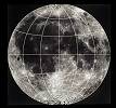
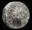
-- Moon Map and Apollo Landing Sites TOP __
本文中のリンクを同じウィンドウに開く (現) 本文中のリンクを新しいウィンドウに開く (切り替え)


Nearside Locator Map


Clementine 2 Nearside


Clementine 2 Farside

Apollo 11  Mare Tranquillitatis (静かの海) = Sea of Tranquility ( LM ) 0.67408 degrees N, 23.47297 degrees E
Apollo 12 Oceanus Procellarum (嵐の大洋) = Ocean of Storms ( LM ) -3.01239 degrees N, -23.42157 degrees E
Apollo 13 Fra Mauro Highlands (フラ・マウロ高地) -
Apollo 14 Fra Mauro Highlands (フラ・マウロ高地) ( LM ) -3.64530 degrees N, -17.47136 degrees E
Apollo 15 Hadley-Apennine (ハドリー・アペニン) ( LM ) 26.13222 degrees N, 3.63386 degrees E
Apollo 16 Descartes Highlands (デカルト高地) ( LM ) -8.97301 degrees N, 15.50019 degrees E
Apollo 17 Taurus-Littrow (タウルス・リトロー) ( LM ) 20.19080 degrees N, 30.77168 degrees E

ランディングポイント (場所、値) の詳細については こちらのページを参照のこと

- - - - -
※ アポロ13号は酸素タンク爆発事故で着陸を中止している
※ 「アポロ月面基地 (着陸地点)」 については、Lunar Module、LRRR、ALSEP等を基準に (あるいは相対的に) 値を算出している
※ アポロ12号のランディングサイト 「嵐の大洋」 は、1976年に IAU (国際天文学連合) が Mare Insularum (島の海) と命名している
※ アポロ11号〜17号のランディングポイント (着陸地点) のロケーションは、アポロ当時の値ではなくコーディネートした値を用いている


 End of oon map and Apollo Landing sites 

__ Reference
National Aeronautics and Space Administration (NASA)
Kennedy Space Center (KSC)
Jet Propulsion Laboratory (JPL)
Goddard Space Flight Center (GSFC)
Johnson Space Center JSC Home Page (JSC)
National Space Science Data Center (NSSDC)
American Astronomical Society (AAS)
CHECKOUT and LAUNCH CONTROL SYSTEM PROJECT (CLCS)
_ Moon Investigation LogoMoon Investigator Badge

Writer : Masaaki Umehara
Contact us : Email
Search Engines : http://www.masaakix.interlink.or.jp/db/
The Apollo Program : http://www.masaakix.interlink.or.jp/apollo/
Hal's Eyes Web Site / Home : http://www.masaakix.interlink.or.jp/

当サイトの著作権及び閲覧ガイド